On Saturday, February 20, 2021, ScienceHeads (a STEM education group out of Lake Forest, CA, US) launched and successfully recovered their sixth high altitude balloon (HAB). It carried a flight recorder that I built, as well as several radios for tracking and seeds for student experiments. I was member of the recovery team chasing the balloon over the desert to its landing 160 miles away. Photos of the launch and recovery, as well as a video of the landing can be found here.
Projected vs. Actual Paths
In the days and hour before before the flight, we used two web sites to predict the path and landing site of the balloon: ASTRA and HabHub. ASTRA appears to be more compressive since it asks for more parameters, runs several random scenarios, and presents multiple probabilities. However, in this case, Habhub was more accurate and updates the predicated path based on real-time data.
The balloon payload contained an APRS transmitter that sends the balloon’s GPS locations via a network of amateur radio stations to a website APRS.fi. This website enables us to follow the balloon in real-time as long as the transmitter is within range of a receiving station.
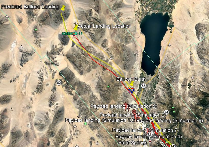
The image below shows the ASTRA and HabHub projected paths compared to the actual path of the balloon. The white projections show 10 of the simulated paths predicted by ATSRA. Note it predicated a higher altitude before bust and a much faster descent. The yellow path is the HabHub predication before launch. The red path shows the actual path as reported on APRS.fi
Note it ends prematurely due to lost of radio signal in the remote desert.

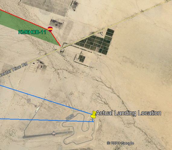
Looking at a directly overhead view, you can see the actual landing site was close to the last GPS fix provided by APRS.fi (shown in red). And at considerable distance for those projected by ASTRA (shown in white).
The balloon also contained a GPS tracker that reported location via the cellular network. It closely reported the final location (its path shown in blue, the last reported APRS position shown in red.) The payload also contained a radio beacon and the recovery team had directional antennas, so we would have located the payload via triangulation if we did not have an accurate GPS fix. ScienceHeads thanks to the Chuckwalla Valley Raceway for allowing us access to their property to retrieve the balloon payload..
Flight Recorder Data
The flight recorder contained a 9-degree motion sensor (accelerometer, gyroscope, magnetometer) and an altitude / temperature sensor that recorded data every half second. The data was synchronized to the GPS coordinates provided by APRS.fi and plotted using CODAP – the Common Online Data Analysis Platform.
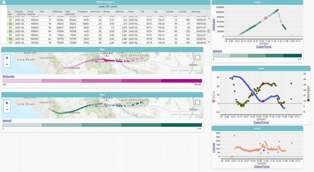
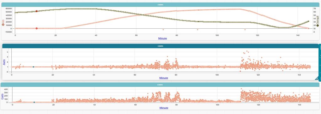
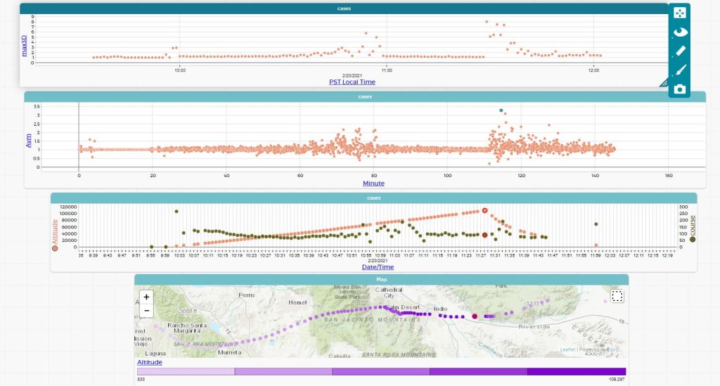
Below is a link to the .CSV file containing the merged APRS and flight recorder data. https://drive.google.com/file/d/12ZlZ6MuM9o0lI3MCDqgGC55eau2tExLu/view?usp=sharing
Instructions for use of CODAP with this file can be downloaded here.
 Fredric Raab